Sep 15, 2017

Longsheng Rice Terrace (Dragon's Backbone), Longsheng County, Guangxi, China.

The Longsheng Rice Terrace, also called the Longji Rice Terraces are located in Longsheng County, about 100 kilometers (62 mi) from Guilin, Guangxi, China.

The terraced fields are built along the slope winding from the riverside up to the mountain top, between 600 to 800 meters (2,000 to 2,600 ft) above sea level. A coiling terrace line that starts from the mountain foot up to the mountain top divides the mountain into layers of water in spring, layers of green rice shoots in summer, layers of rice in fall, and layers of frost in winter. The terraced fields were mostly built about 650 years ago.

Longji (Dragon's Backbone) Terraced Rice Fields received their name because the rice terraces resemble a dragon's scales, while the summit of the mountain range looks like the backbone of the dragon. In early June, water is pumped over the rice paddies and young plants are transferred to the main terraces.


The Dragon's Backbone Rice Terraces is a beautiful natural picture. The linked together rice terraces vary from season to season. In spring, the water is irrigated into the fields and the terraces look like great chains or ribbons hung on the hillsides. When the onset of summer, green waves rush continuously down the mountainside from the heaven. The theme of autumn is the harvest, with the mountainside decorated with the gold of ripened millet. Coming into winter, the whole mountain will be covered with white snow, just like dragons playing with water.
As well as its amazing scenery, Longji is also the area to visit to experience China’s ethnic minorities' culture. The Zhuang and the Yao nationalities live here, though mainly it is the Zhuang people. The women dress in unique and colorful costumes, singing and dancing. Guests also can join in with them to enjoy the original Zhuang life and culture, and even stay with local families enjoying both the Longji tea and the Longji wine.
For More Details - Official Website

Sep 14, 2017

Liechtensteinklamm, Salzburg, Austria

Liechtensteinklamm (Liechtenstein Gorge) is a particularly narrow gorge with walls up to 300m high, located in the Austrian Alps 50 km south of Salzburg. It is around 4 km long and named after Johann II of Liechtenstein who had the walkways installed in 1875.

The gorge is around 4 km in length of which 1 km is accessible to visitors by means of wooden walkways (closed in winter months). It has a depth of up to 300m and in some places is only a few meters wide. At the end of the gorge is a waterfall. It receives around 100,000 visitors a year.

The waters of the Großarler Ache, a mountain stream, formed the gorge over thousands of years. In 1875 work began by members of the Pongau Alpine Club to make the gorge accessible, however was unfinished due to a lack of funds. Prince Johann II. of Liechtenstein, who ran a hunting lodge in the nearby Großarl, donated 600 guilders for an expansion of the work. At the completion of work in 1876 the gorge was renamed to honour the generous donation from the Prince. According to legend, the gorge was created when the devil full of anger and rage over a failed plan, flew across the canyon throwing water into it with such force as to carve the rock.


One of the deepest and longest ravines in the Alps, the Liechtensteinklamm is off the beaten track but well worth the detour. The jaw-dropping chasm was carved out during the last Ice Age; it's named after Johann II, Prince of Liechtenstein, who poured plenty of money into making the gorge accessible in the 19th century. Following raging waters flanked by vertical 300m-high cliffs, the footpath crosses bridges and passes through tunnels gouged into slate cliffs veined with white granite.
The mossy boulders and crags glisten with spray from the water, which is at its most striking in the late afternoon when the sunlight turns it opal blue. The trail culminates at a spectacular 50m waterfall. Allow at least an hour to walk the gorge. Trains run frequently between Werfen and St Johann im Pongau, a 4km walk from the gorge

Sep 13, 2017

Chamarel Seven Coloured Earth, Rivière Noire District, Mauritius

The Seven Coloured Earths are a geological formation and prominent tourist attraction found in the Chamarel plain of the Rivière Noire District in south-western Mauritius. It is a relatively small area of sand dunes comprising sand of seven distinct colours (approximately red, brown, violet, green, blue, purple and yellow). The main feature of the place is that since these differently coloured sands spontaneously settle in different layers, dunes acquire a surrealistic, striped colouring. Another interesting feature of Chamarel's Coloured Earths is that the dunes seemingly never erode, in spite of Mauritius' torrential tropical rains.

The “seven-coloured earth” of Chamarel is a geological curiosity and a major tourist attraction of Mauritius. This is a small (7500 m2) area of strikingly bare landscape located within a large, dense forest. The earth is particularly unusual; created by volcanic rocks that cooled at different temperatures, the earth form beautiful patterns of colour in the exposed hillsides. The rocks were pulverized into sands with various shades of red, brown, grey, and purple. Since the earth was first exposed, rains had carved beautiful patterns of many colours into the hillside. When visiting the park, you will be able to walk between the many sand dunes, along trails and see this unique sight. Also, there is a small petting farm where you can see and pet Giant Turtles which found their home at the park.


Since the earth was first exposed, rains had carved beautiful patterns into the hillside, creating an effect of earthen meringue. At first you'll notice shadows on the hills, creating the illusion of different colours, but soon you realise that the colours are real and the shadows were the illusion.

Sunrise is the best time to see the Coloured Earths. Geologists are still intrigued by the rolling dunes of multi-coloured lunar-like landscape. The colours, red, brown, violet, green, blue, purple and yellow never erode in spite of torrential downpours and adverse climatic conditions.

The Colored Earth of Chamarel has become one of Mauritius' main tourist attractions since the 1960s. Nowadays, the dunes are protected by a wooden fence and visitors are not allowed to climb on them, although they can look at the scenery from observation outposts placed along the fence. Curio shops in the area sell small test-tubes filled up with the coloured earths.

Aug 28, 2017

Munnar (The Kashmir of South India), Kerala, India

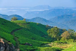
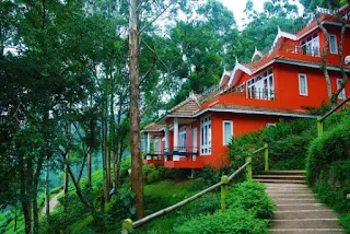
Munnar  is a town and hill station located in the Idukki district of the southwestern Indian state of Kerala. Munnar is situated at around 1,600 metres (5,200 ft) above mean sea level, in the Western Ghats range of mountain. Munnar is an idyllic hill station, famous for its tea estates, exotic scenery, abundance of flora and fauna and craggy peaks.

One of the biggest tea-plantation area of South India, Munnar is one of the most beautiful and popular hill-stations of Kerala. Situated on the
three mountain streams merge - Mudrapuzha, Nallathanni and Kundala. 1,600 m above sea level, this hill station was once the summer resort of the erstwhile British Government in South India blessed with natural view-points apart from the tea-plantations. Munnar is divided into Old Munnar, where the tourist information office is, and Munnar, where the bus station and most guest houses are located. The Eravikulam National Park, Salim Ali Bird Sanctuary and tea plantations are its major attractions.


Sprawling tea plantations, picturesque towns, winding lanes and holiday facilities make this a popular resort town. Among the exotic flora found in the forests and grasslands here is the Neelakurinji. This flower which bathes the hills in blue once in every twelve years, will bloom next in 2018. Munnar also has the highest peak in South India, Anamudi, which towers over 2,695 m. Anamudi is an ideal spot for trekking.

Eravikulam National Park

One of the main attractions near Munnar is the Eravikulam National Park. This park is famous for its endangered inhabitant - the Nilgiri Tahr. Spread over an area of 97 sq. km., this park is also home to several species of rare butterflies, animals and birds. A great place for trekking, the park offers a magnificent view of the tea plantations caressed by blankets of mists. The park becomes a hot destination when the hill slopes here get covered in a carpet of blue, resulting from the flowering of the Neelakurinji. It is a plant endemic to this part of the Western Ghats which blooms once in twelve years.

Anamudi Peak

Located inside the Eravikulam National Park is the Anamudi Peak. This is the highest peak in South India, standing at a height of over 2700 m. Treks to the peak are allowed with permission from the Forest and Wildlife authorities at Eravikulam.

Mattupetty

Another prime draw for visitors, located about 13 km from Munnar Town, is Mattupetty. Situated at a height of 1700 m above sea level, Mattupetty is known for its storage masonry dam and the beautiful lake, which offers pleasurable boat rides, enabling one to enjoy the surrounding hills and landscape. Mattupetty's fame is also attributed to the dairy farm run by the Indo-Swiss Livestock Project, where one can encounter different high yielding breeds of cows.

Pallivasal

Pallivasal, located at about 3 km from Chithirapuram in Munnar is the venue of the first hydro-electric project in Kerala. It is a place of immense scenic beauty and is often favoured by visitors as a picnic spot.

Chinnakanal & Anayirangal

Near Munnar Town lie Chinnakanal and its waterfalls, popularly known as the Power House Waterfalls, which cascade down a steep rock 2000 m above sea level. The spot is enriched with a scenic view of the Western Ghat ranges. When you have traveled about seven kilometers from Chinnakanal, you reach Anayirangal. Anayirangal, 22 km from Munnar, is a lush green carpet of tea plants. A trip on the splendid reservoir is an unforgettable experience. The Anayirangal dam is surrounded by tea plantations and evergreen forests.

Top Station

Top Station, which is about 32 km from Munnar is at a height of 1700 m above sea level. It is the highest point on the Munnar-Kodaikanal road. Travellers to Munnar make it a point to visit Top Station to enjoy the panoramic view it offers of the neighbouring state of Tamil Nadu. It is among the prime spots in Munnar to enjoy the Neelakurinji flowers blooming over a vast area.

Tea Museum

Munnar has a legacy of its own when it comes to the origins and evolution of tea plantations. Taking account of this legacy and to preserve and showcase some of the exquisite and interesting aspects of the genesis and growth of tea plantations in Kerala's high ranges, a museum exclusively for tea was opened some years ago by Tata Tea in Munnar. This Tea Museum houses artifacts, photographs and machinery; all of which have a story to tell about the origins and growth of tea plantations in Munnar. The museum is located at the Nallathanni Estate of Tata Tea in Munnar and is worth a visit.

Jun 24, 2017

Son Bhandar Caves (Cave Of lost Gold), Rajgir, Bihar State, India

Son Bhandar Caves situated at Rajgir, Nalanda in Bihar state. Son bhandar group of caves has two caves known as eastern and western cave. Son bhandar caves are concerned with Jainism and considered to belong to 3-4 century AD. These caves were first inspected by cunninghum and he concluded to have analogy with saptparni caves of Buddhism creed. After cunninghum several scholars visited this place and some had opinion to concern with Buddhism. After some time all Buddhism connections were refused because of an inscription found on the southern wall of a cave. According to this inscription these caves were built by inspiration of a Jain muni Vair for Jain ascetics. Sculptures of Teerthankaras were also carved in these caves. From architectural aspect; these caves are analogous to Nagarjuni cave and Barbar caves of Mauryan era. Therefore it can be concluded that construction time should not be much differ from above mentioned caves. These caves should be related to digambar sect of Jainism as Xuanzang wrote in his book about Vaibhar hill of rajgir that the place was occupied by Digambar Jaina monks for meditation purpose. After some centuries these caves were converted by Hindus as Lord Vishnu sculpture was also found from mound of a cave. 


It is the western cave which gave the name to monument: Son Bhandar means "store of gold" and legend about this treasure is linked to western cave.

The cave believed to be a guard cave – contains single rectangular chamber, 10.4 x 5.2 m large. The vaulted ceiling stands stands on vertical walls, vault rises up to 1.5 m high. This resembles the style of older Mauryan rock-cut sanctuaries. In ancient times most likely there was a roofed verandah in the front of caves.

Walls, doorjambs and front wall contains numerous epigraphs. Small image of standing Vishnu is etched on the left side of doorway this possibly testifies that caves were taken over for Hindu worship. Local legend tells that the this cave still hides a passage to the treasury of gold entrance in this passage is well hidden in the cave chamber behind an ancient stone wedge. Some also believe that the passage goes through Vaibhargiri mountain and reaches Saptaparni Caves on the other side of range. Some believe that this treasure belongs to Jarasandha, others that to Bimbisara. In a case of Bimbisara legend goes that when Ajatashatru confined his father Bimbisara (remnants of this prison are nearby), his mother secretly hid some wealth and later donated it to Tirthankar.

In the wall of cave there is seen a trace of carving, resembling a doorway and next to it – an undeciphered inscription in Sankhlipi writing or shell script. It is believed that this inscription is a password who will read it, will open the door and enter the passage. This ornate script has been found in India as well as in Java and Borneo and never been deciphered. There is also a black mark above or in the upper part of the mysterious doorway is of left by cannonball when Brits tried (without success) to break the wall and enter the passage. 

Eastern cave is partly ruined – front part of cave chamber has fallen. Upper floor above the cliff made in brick is added later, during Gupta period and possibly caused the collapse of front wall of the cave. Most likely also this cave had verandah in front. Southern wall of this cave contains important early Jain artwork – exquisitely sculpted small reliefs of six Jain Tirthankaras – Padmaprabh, Parsvanath, Mahavira and others. This relief seems to be added later, some time after the completion of caves, it shows little congruity with the plan of rock-chamber.